Search Field Solutions & Services

Trimble X9 3D Laser Scanner

Versatile advanced scanning and imaging you can depend on.

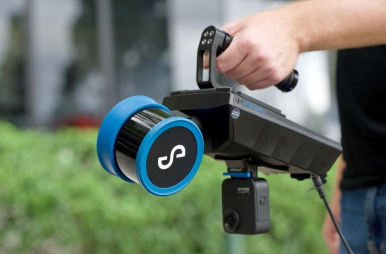
The Trimble X9 3D Laser Scanner is engineered for reality capture teams, BIM/VDC managers and scanning professionals who demand faster, more accurate and higher-quality data than what the industry-proven Trimble X7 delivers. With enhanced range, scan speed and advanced automation, the X9 sets a new standard for mobile scanning performance and efficiency.

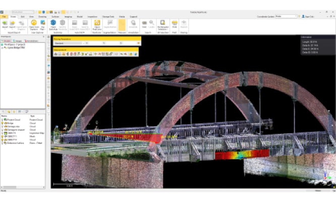
Whether you’re documenting complex building interiors, creating detailed as-built models or supporting BIM workflows, the Trimble X9 combines cutting-edge hardware with intuitive software integration, which helps you capture reality data and get results that drive decisions.

What Makes the Trimble X9 Stand Out?

The Trimble X9 3D Laser Scanner builds upon the foundation of the X7 with enhancements that matter to scanning teams.

1. Faster Scan Speeds

With a maximum speed of 1,000 kilohertz, the X9 captures dense point clouds in less time, increasing productivity on every jobsite. Faster capture means you spend less time waiting and more time validating data on the spot.

2. Extended Range

The X9’s range extends up to 150 meters, nearly double the effective range of the X7 (80 meters). This extended reach lets you scan larger areas from fewer setups. This is particularly useful for big interiors, large industrial facilities or exterior building scans.

3. Superior Sensitivity and Accuracy

The X9 delivers high-fidelity capture even on challenging surfaces, such as dark, reflective or textured materials. This ensures that you have usable data across a variety of conditions. Combined with an angular accuracy of 16 inches, it strikes a balance between precision and performance that enhances modeling quality.

4. Intelligent Automation

One of the most compelling features of the Trimble X9 is its auto-calibration system, powered by Trimble’s X-Drive technology. Unlike traditional scanners, the X9 continuously calibrates itself in the field to maintain accuracy, eliminating the need for annual calibration service and reducing downtime.

Self-leveling features make setup faster and easier, especially in dynamic conditions where perfect tripod leveling is difficult. Together with auto-calibration, these features boost confidence in your data while saving valuable field time.

Applications & Specs

What is the Better Choice? X9 vs. X7

Comparing the X9 vs. X7 highlights meaningful differences for professional scan teams:

  X9 X7
Range Up to 150 meters Up to 80 meters
Scan Speed Up to 1,000 kilohertz Up to 500 kilohertz
Scan Times Faster overall captures Slower overall captures
Auto-Calibration Efficiency Minimizes calibration time after initial warmup More calibration time required

These improvements translate into broader site coverage, quicker workflows and richer data.

Software and Workflow Integration

The Trimble X9 is more than hardware. It's part of a connected reality capture ecosystem. Scan data integrates seamlessly with:

  • Trimble Perspective and Trimble FieldLink for field control and in-field registration.
  • Trimble RealWorks and Trimble Business Center for advanced processing and modeling.
  • Industry-standard tools like SketchUp and Tekla for downstream BIM workflows.

This ecosystem approach simplifies BIM to deliverables, enabling you to validate data, refine models and coordinate across teams more effectively.

Drive Better Results With BuildingPoint SouthEast

The Trimble X9 3D Laser Scanner delivers a powerful combination of speed, range, automation and integration. Whether you’re upgrading from the X7 or evaluating scanners for new workflows, the X9 drives field efficiency and rich data capture with confidence.

Request a demo or quote today to see how the Trimble X9 can elevate your reality capture workflows.

Key Features & Benefits

Proven
  • Simple and efficient workflows
  • Smart auto-calibration and self-leveling
  • Durable, compact, and lightweight with a backpack for easy transport
  • Trimble FieldLink software to easily manage and validate projects in the field with auto-registration 
Versatile
  • Long range with accuracy and data quality
  • High sensitivity to capture difficult dark and shiny surfaces
  • High-speed scanning to reduce scan times and effectively increase scan density
Reliable
  • Automatic registration, refinement, and report
  • Laser pointed for georeferencing and single-point measurements
  • IP55 rating and wide operating temperature range for demanding environments
  • Backed by a 2-year standard warranty